Infrastructure
Sewer, stormwater and water supply networks are built in the same drawing, from the manhole to the trench volumes. Levels come from the institution's rules and errors are fixed with one click.
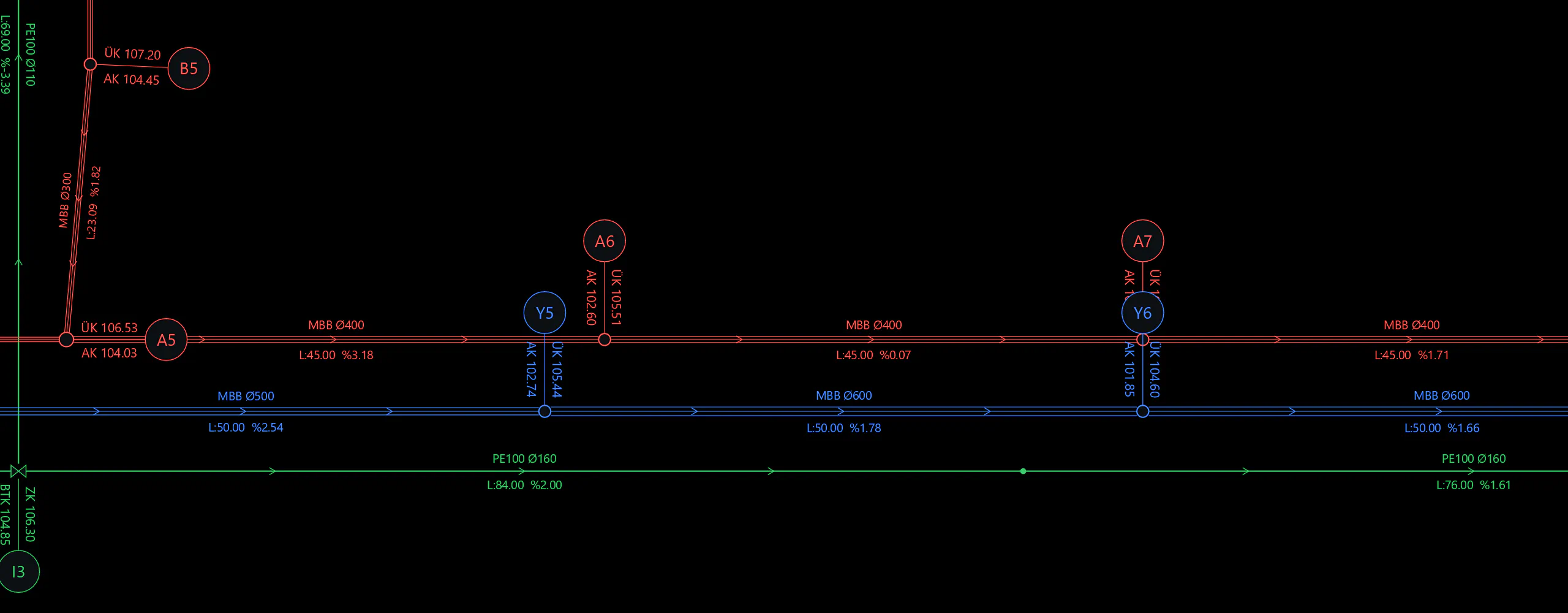
Building the network
The manhole and pipe network is built in the drawing. Levels are taken from the rules of the institution you choose. Several networks sit side by side in the same drawing.
- Manholes and pipesManholes and pipes are placed along the line
- LevelsInvert levels come from the institution's rules
- Several networksSewer, stormwater and water supply in the same drawing
- CatalogueManhole and pipe products are chosen from a catalogue
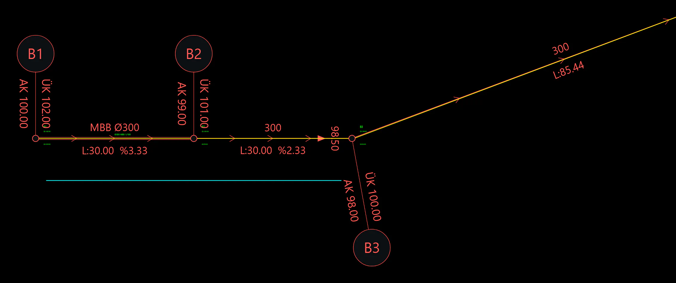
Network from existing data
There is no need to redraw the network from scratch. It is built from the data you already have.
- Old drawingThe network is extracted from the lines and text of an old drawing
- Field surveyFrom GSI, CSV and Excel files
- LandXMLFrom the pipe network in a LandXML file
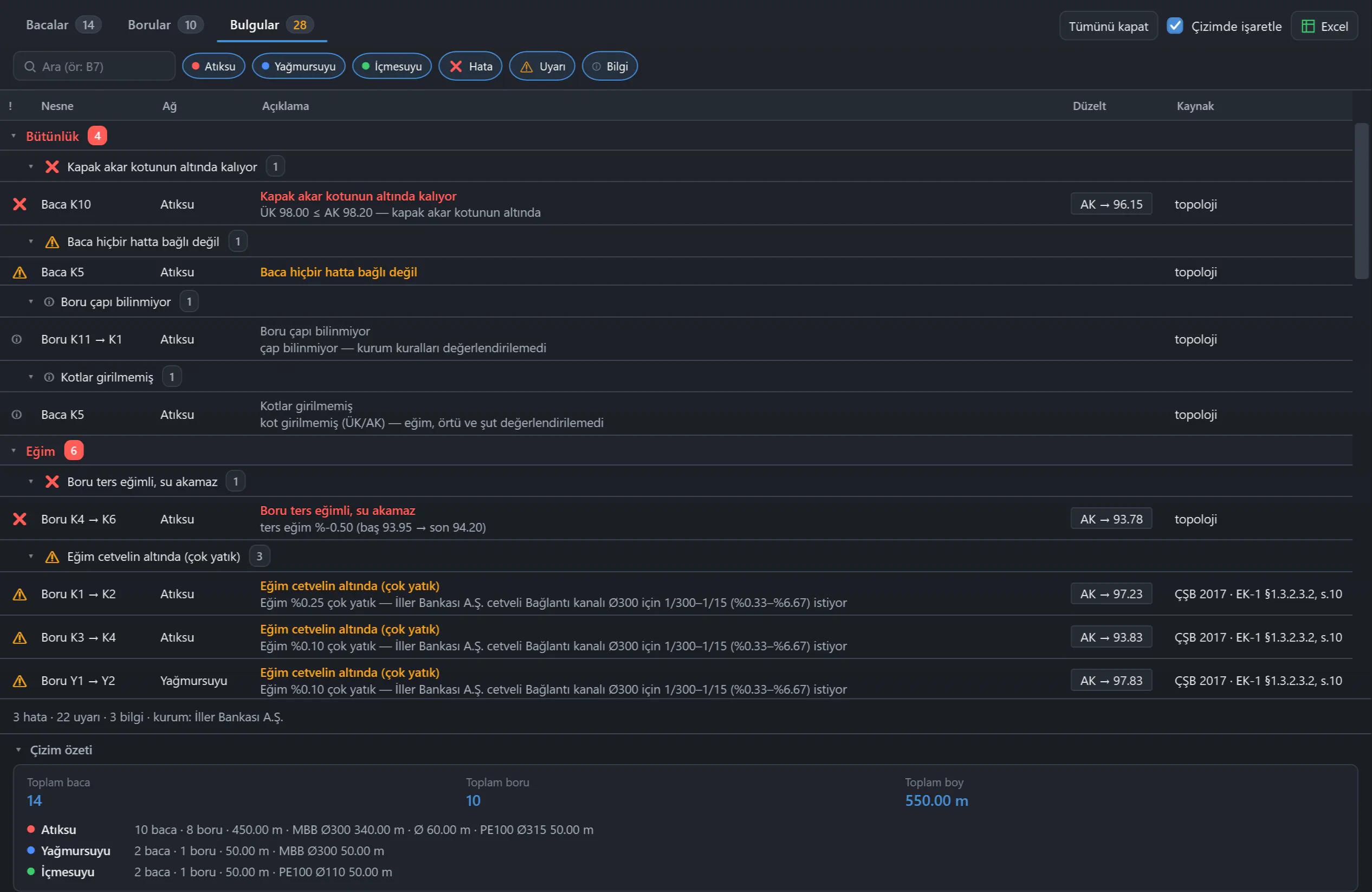
Rule check
The network is checked against the rules of the selected institution. What is non-compliant is listed; errors are fixed with one click.
- Slope and coverCompared with the rule limits
- Velocity and dropCompared with the rule limits
- Manhole spacingCompared with the rule limits
- Network recordsManholes and pipes in a table; findings listed by heading
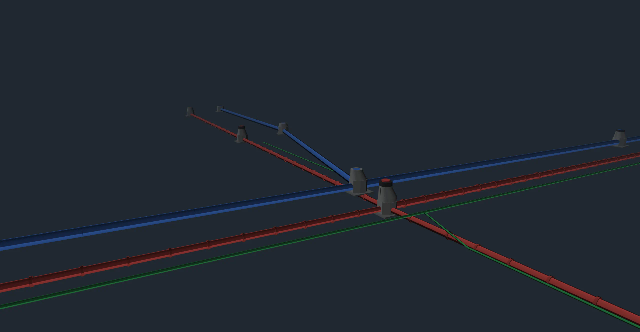
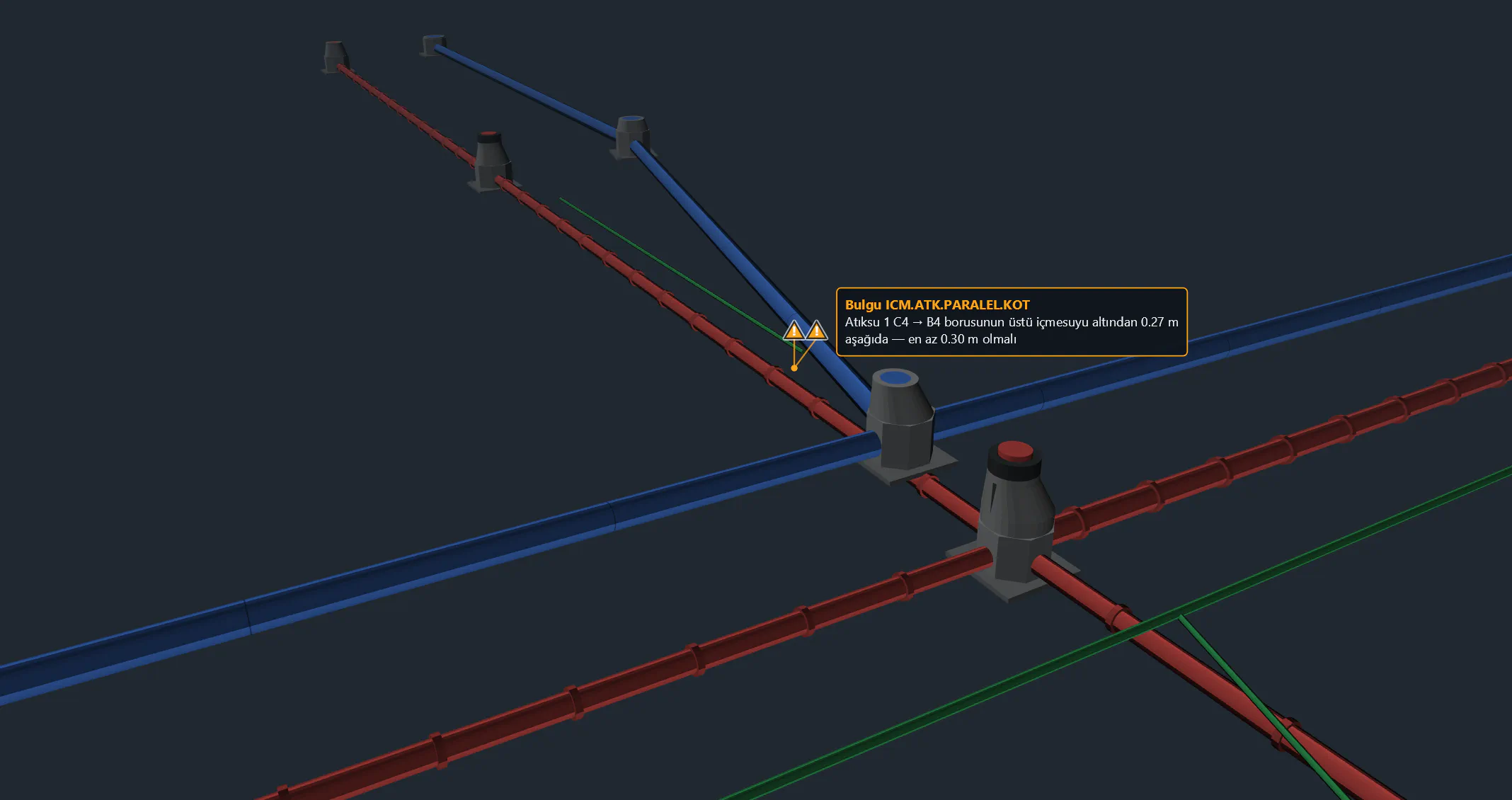
3D and clashes
Manhole and pipe bodies are visible in 3D below the terrain. The x-ray view lets you read what is inside the ground.
- X-ray viewThe network is visible below the terrain
- Show or hide network by networkEach network is switched on and off separately
- ClashesCrossings between networks are marked in 3D and added to the findings list
Trench volumes
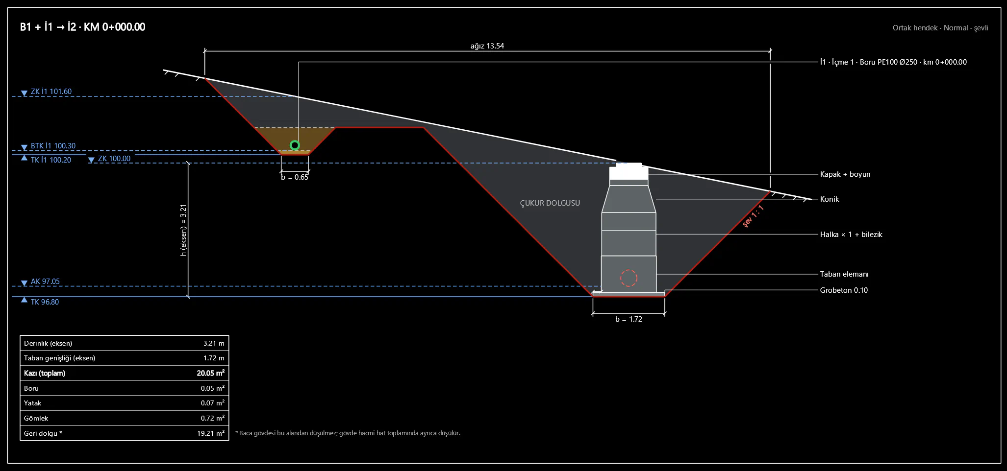
Trench excavation, bedding, surround, manholes and backfill are calculated separately. Several networks in the same trench are handled together.
- ItemsExcavation, bedding, surround, manholes, backfill
- Shared trenchIncluding benches and sloping ground
- Network tableDelivered as an Excel file
Longitudinal profile
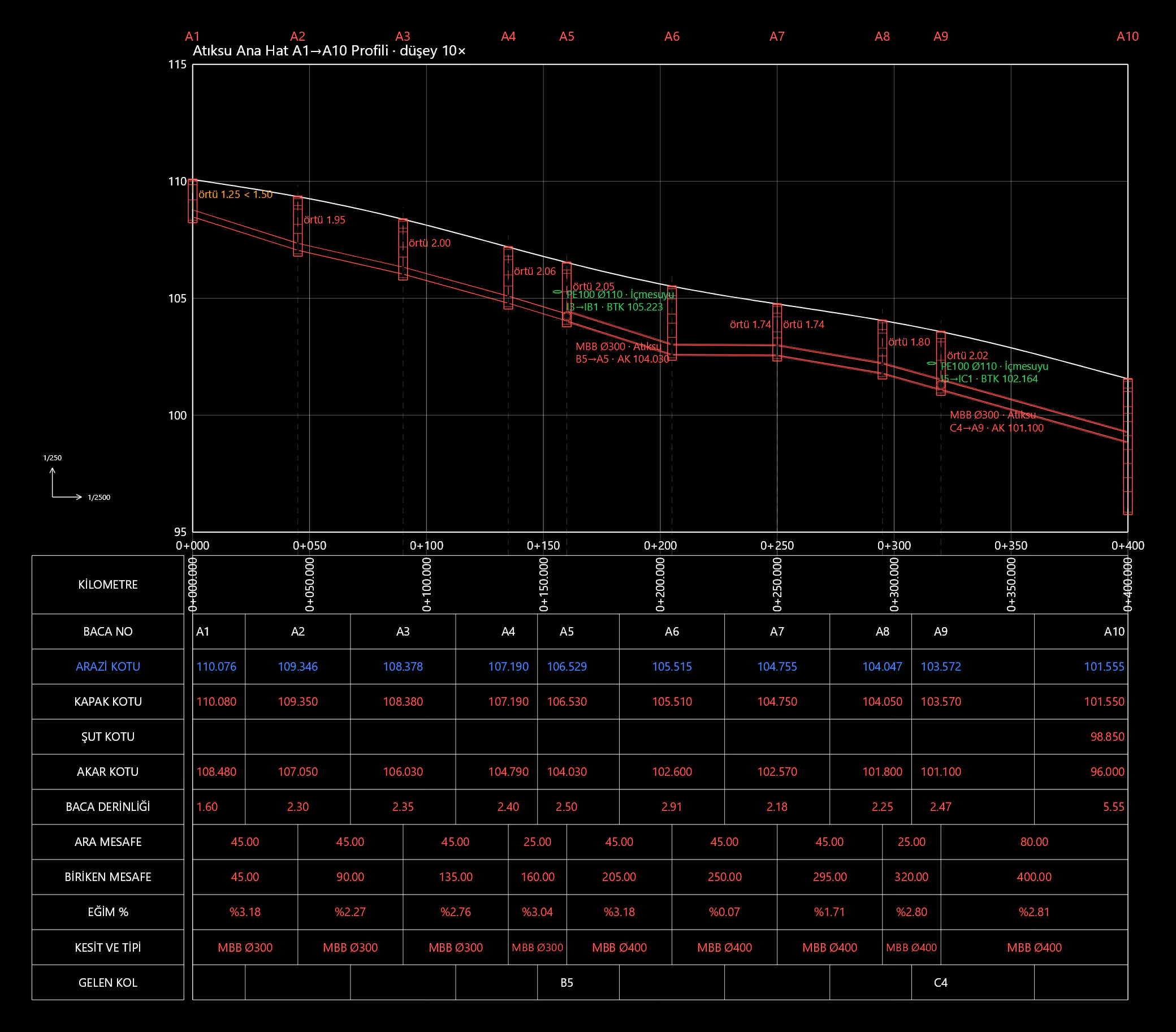
The pipeline's longitudinal profile is drawn as a sheet together with the terrain, pipe and manholes.
- Terrain and pipeOn the same profile
- ManholesWith their positions and levels
- OutputDXF
Trench cross-section and manhole detail
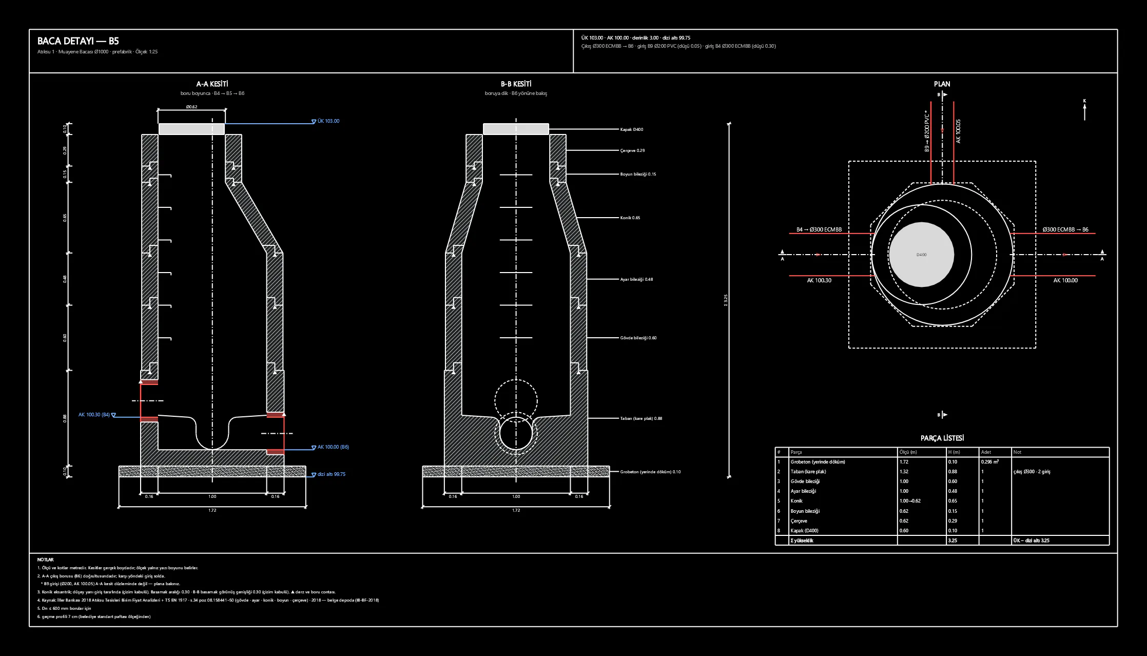
The trench cross-section and the manhole detail come out of the drawing as sheets.
- Trench cross-sectionCross-section sheet of the trench
- Manhole detailSections, plan and parts list
- OutputDXF
Outputs
| Deliverable | Format |
|---|---|
| Longitudinal profile sheet | DXF |
| Trench cross-section · manhole detail | DXF |
| Utility network table | XLSX |
| Alignment and surface data | LandXML |
Plainly: what it does not do
- It does not calculate pipe diameter or flow (there is no hydraulic calculation).
- There is no catchment calculation.
- It does not produce institutional payment schedules.
Related demos
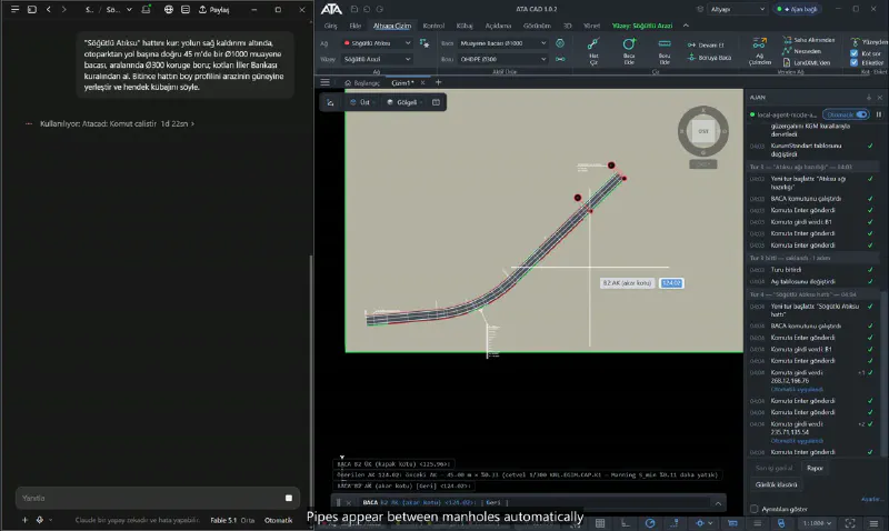 1:27
Waste water line, longitudinal profile, trench volumes
Manholes and pipes are placed, levels come from the institution's rules. The longitudinal profile and trench volumes come out in the same chat.
Infrastructure 6:26
From terrain to 3D model
Terrain, road, waste water line, buildings and landscape in a single chat.
Full video