Capabilities
What ATA CAD does in the current version and what is being worked on, in groups.
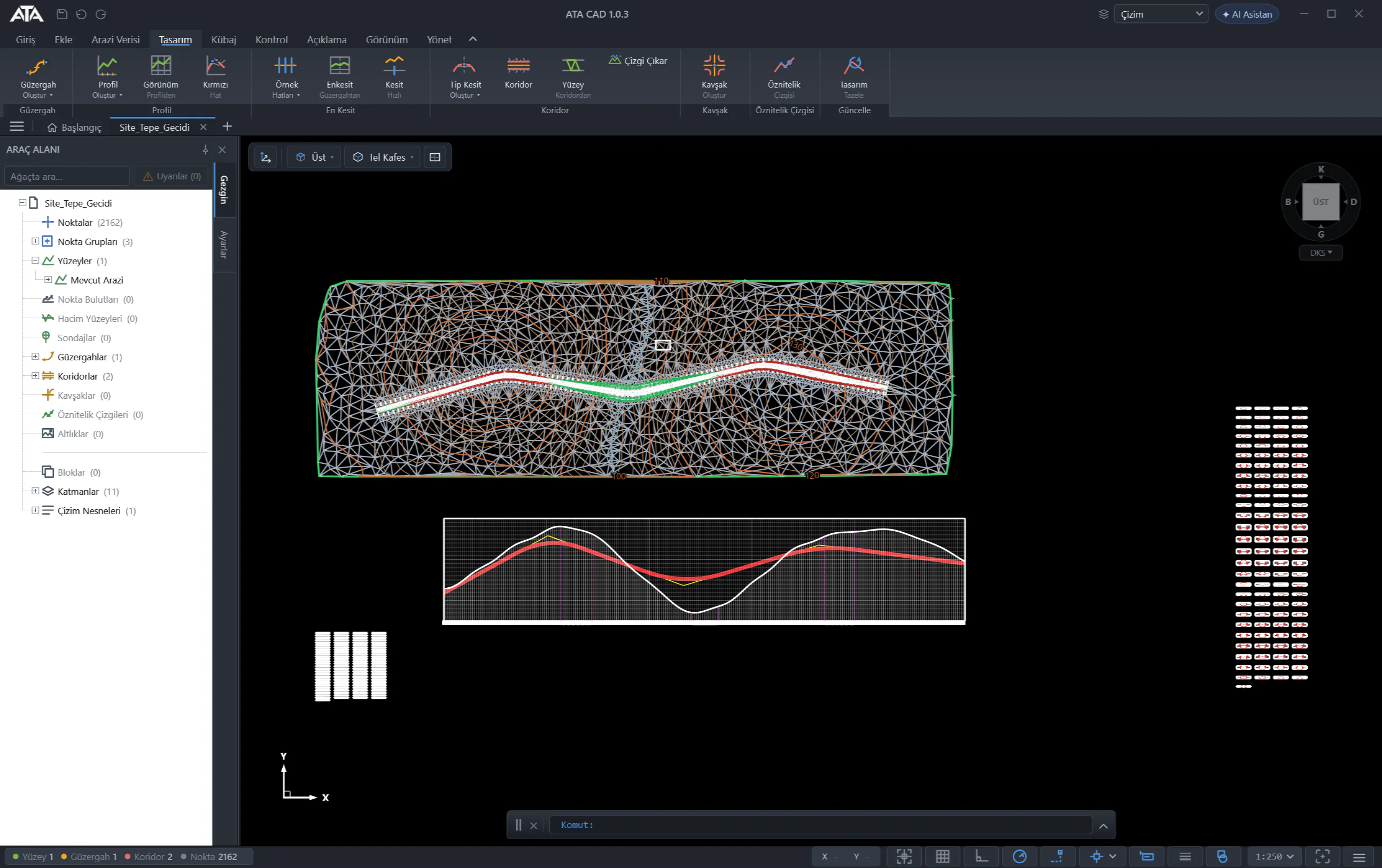
available = used in the current version. in progress = being worked on, no date given. The interface and commands are in Turkish.
Drawing core
| Capability | Details | Status |
|---|---|---|
| Turkish interface and commands | available | |
| No other CAD licence required | The program runs on its own | available |
| Road, utility network and 3D model in one file | available | |
| Three workspaces | When the workspace changes the ribbon changes; the drawing stays the same | available |
| Old drawings with Turkish characters | available | |
| Dimensions, text and tables | available | |
| Blocks and external references | available |
Terrain
| Capability | Details | Status |
|---|---|---|
| Points and TIN surface | available | |
| Point editor and point groups | available | |
| Surface sources | Points, elevation labels, triangles, DEM, LandXML | available |
| LAS/LAZ point cloud | available | |
| Borehole columns and log sheets | Excel, CSV, AGS4 | available |
| Stratum surface | available | |
| Satellite imagery and institutional background maps | Including institutional WMS background maps | available |
| Projection zone suggestion | From the province boundary | available |
| DWG and DXF underlay | Read only; DWG is not written | available |
Alignment and profile
| Capability | Details | Status |
|---|---|---|
| Curve and spiral (clothoid) | available | |
| Superelevation | Per KGM | available |
| KGM plan display | Curve data block, superelevation band | available |
| Vertical curve | From the KGM handbook tables | available |
| Longitudinal profile and design profile | The sheet is delivered as DXF | available |
| Superelevation band on the profile | available | |
| Wall longitudinal profile | in progress |
Corridor and intersection
| Capability | Details | Status |
|---|---|---|
| KGM typical section library | available | |
| Typical section from a drawing | available | |
| Corridor surface | available | |
| Quick section | available | |
| Corridor | 3D road model from the alignment, design profile and typical section | available |
| At-grade intersection | available | |
| Roundabout | available |
Earthwork volumes
| Capability | Details | Status |
|---|---|---|
| Cut and fill volume | available | |
| Soil class | available | |
| Site grading | available | |
| Excavation design | Formation level, slope, benches | available |
| Volume between two surfaces | available | |
| Volume dashboard | available | |
| Mass haul diagram | Haul-balanced; delivered as DXF | available |
| Periodic volumes | XLSX | available |
| Earthwork volume schedule | XLSX · CSV | available |
| Cross-section sheets | DXF | available |
Infrastructure
| Capability | Details | Status |
|---|---|---|
| Manhole and pipe network | Levels from the institution's rules | available |
| Manhole and pipe catalogue | available | |
| Several networks | In the same drawing | available |
| Network records and findings | Table and findings list | available |
| Rule check | Slope, cover, velocity, manhole spacing, drop; errors are fixed with one click | available |
| Network from existing data | Old drawing, field survey (GSI, CSV, Excel), LandXML | available |
| 3D x-ray view | Show or hide network by network | available |
| Clashes between networks | Marked in 3D and added to the findings list | available |
| Trench volumes | Shared trench, including benches and sloping ground | available |
| Utility sheets | Longitudinal profile, trench cross-section, manhole detail; DXF | available |
| Each pipe with its own institution table in a shared trench | in progress | |
| 3D speed on large networks | in progress | |
| Utility rule exceptions and an Excel findings sheet | in progress |
3D model
| Capability | Details | Status |
|---|---|---|
| Building elements | Storey, wall, slab, column, beam, stair, roof | available |
| Massing and push/pull | available | |
| Component library | available | |
| Model import | glTF · OBJ · STL | available |
| Building from a floor plan | Walls, columns, openings, rooms | available |
| Openings and shafts | available | |
| Rooms and areas | available | |
| Services | Clean water, waste water, rainwater, heating | available |
| Landscape | Road, car park, green area, play and sports areas sit on the terrain | available |
| Section and floor plan | available | |
| Construction sequence animation | available | |
| Export | IFC 4.3 · glTF | available |
| Architectural grid and facade elements | in progress |
Compliance check
| Capability | Details | Status |
|---|---|---|
| Rules in a data file | available | |
| Type mapping | From drawing layer to object type | available |
| Source, article and date | Every rule carries all three | available |
| What is non-compliant appears in red | available | |
| Landscape rule set | Parking Regulation (Otopark Yönetmeliği), Zoning Regulation for Planned Areas (Planlı Alanlar İmar Yönetmeliği) and two guidelines | available |
| Compliance report | XLSX · PDF · DXF | available |
AI connection
| Capability | Details | Status |
|---|---|---|
| Connects to your own Claude account | available | |
| Requests are written in Turkish | available | |
| The program runs the commands on your screen | available | |
| Every action is visible on screen | available | |
| One-step undo | available | |
| You set the approval threshold | available | |
| No extra charge | You use your own subscription | available |
Data exchange
| Capability | Details | Status |
|---|---|---|
| Reading DWG and DXF | DWG is not written | available |
| Sheets | DXF | available |
| Earthwork volume schedule | XLSX · CSV | available |
| Utility network table | XLSX | available |
| Alignment and surface | LandXML | available |
| 3D model | IFC 4.3 · glTF | available |
| Compliance report | XLSX · PDF · DXF | available |