From terrain to quantities,
one program.
ATA CAD draws the road, the utility network and the 3D model in one file. Earthwork volumes, sheets and quantities come from that model. No other CAD licence required.
The rules of İller Bankası (Turkey's municipal development bank), İSKİ (Istanbul Water and Sewerage Administration) and DSİ (State Hydraulic Works), and the tables of the KGM (General Directorate of Highways) handbook are built into the program.


Rules, tables and sources built in.
Every value used in a calculation carries its source. A value whose source is not verified does not enter the calculation.
Superelevation, spiral (clothoid) and vertical curves come from the tables of the KGM (General Directorate of Highways) Highway Design Handbook 2022. Plan display follows KGM practice: curve data block, superelevation band.
Slope, cover, velocity, manhole spacing and drop are checked against each institution's own rules. National baseline: Resmî Gazete (Official Gazette) 29940.
Several networks are calculated together in the same trench, including benches and sloping ground. Excavation safety thresholds enter the calculation.
Rules live in a data file; every rule carries its source, article and date. The first rule set is landscape: the Parking Regulation (Otopark Yönetmeliği), the Zoning Regulation for Planned Areas (Planlı Alanlar İmar Yönetmeliği) and two guidelines.
Projection zone suggestion from the province boundary, institutional WMS background maps, AGS4 borehole files, old drawings with Turkish characters.
Road. Utilities. 3D model.
The program is organised around three kinds of work. When you switch workspace the ribbon changes; the drawing stays the same.
Infrastructure
Sewer, stormwater and water supply networks, from the manhole to the trench quantities.
- NetworkManholes and pipes, levels from the institution's rules, several networks in one drawing; errors are fixed with one click
- From existing dataBuild a network from the lines and text of an old drawing, from field surveys (GSI, CSV, Excel) or from LandXML
- 3DManhole and pipe bodies below the terrain; x-ray view, show or hide network by network
- ClashesCrossings between networks are marked in 3D and added to the findings list
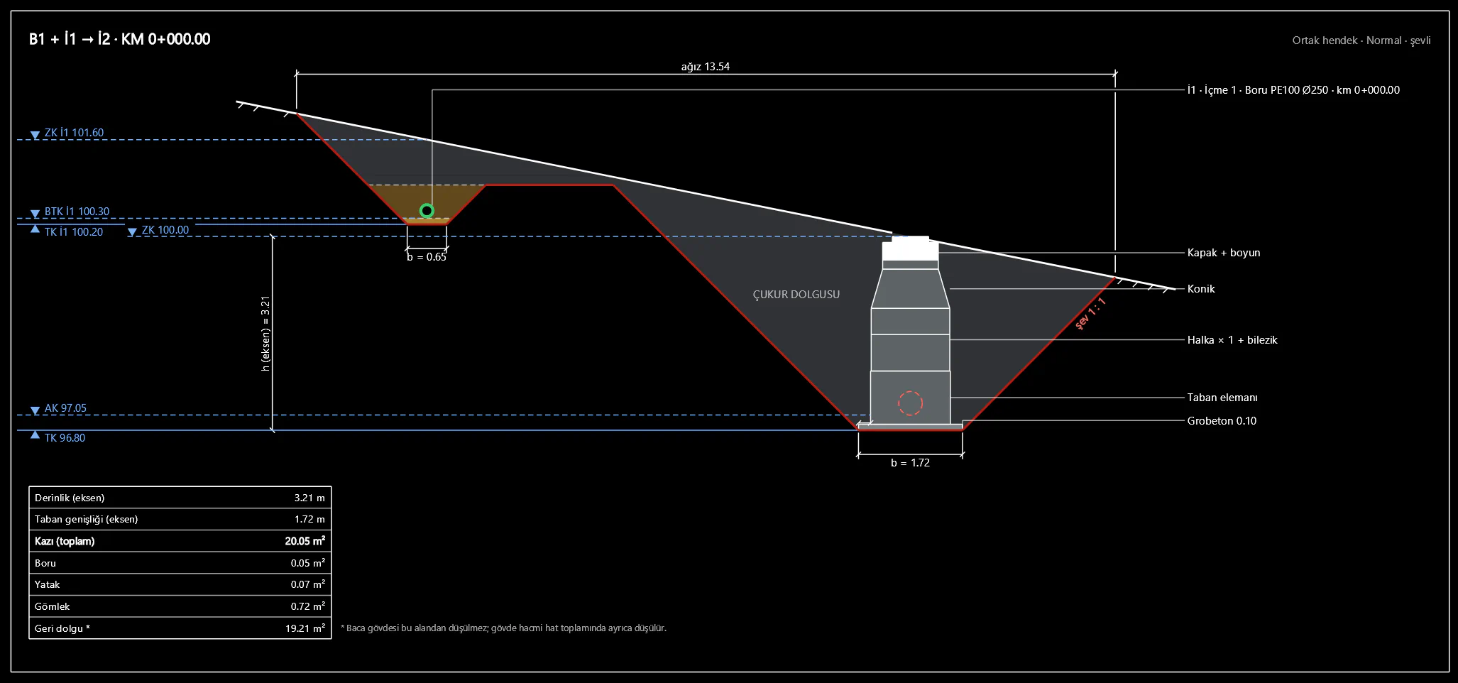
- TrenchExcavation, bedding, surround, manholes and backfill separately; the network table is a six-sheet Excel file
Output: longitudinal profile · trench cross-section · manhole detail sheet
Details →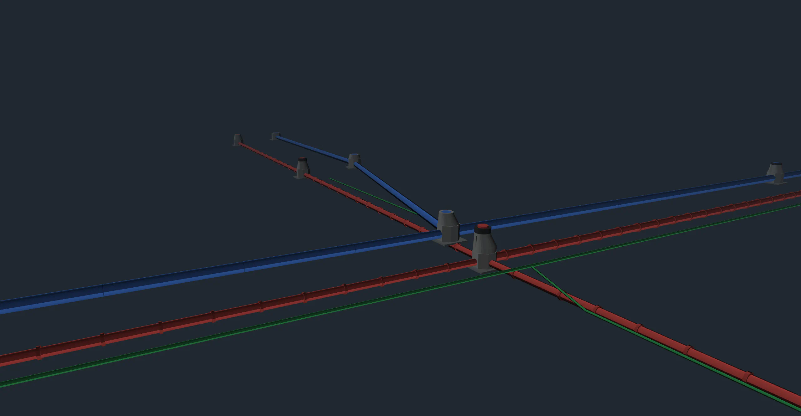
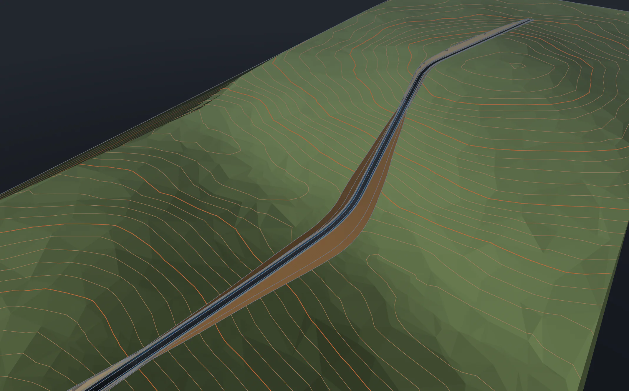
Road and terrain
The whole road project, from the survey point to the mass haul diagram.
- TerrainPoints, TIN surface, LAS/LAZ point cloud, borehole columns and log sheets, satellite imagery and institutional background maps
- AlignmentCurve and spiral (clothoid), superelevation per KGM
- CorridorKGM typical section library, at-grade intersections and roundabouts
- VolumesCut and fill volume, soil class, site grading, haul-balanced mass haul diagram, periodic volumes (progress quantities)
Output: longitudinal profile · cross-section sheets · earthwork volume schedule
Details →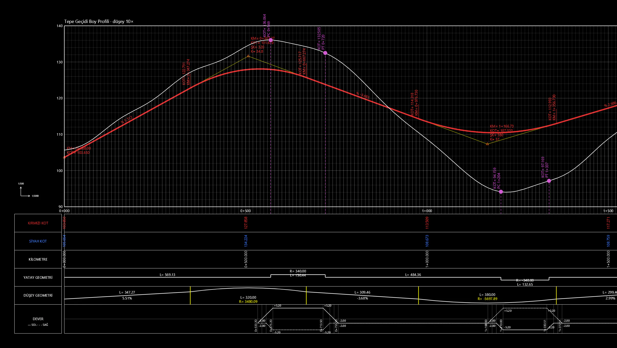
3D model and compliance check
Building, services and landscape in one model. The model is checked against a rule set; the first set is landscape.
- StructureStorey, wall, slab, column, beam, stair, roof
- ServicesClean water, waste water, rainwater and heating lines
- LandscapeRoad, car park, green area, play and sports areas sit on the terrain
- CheckEvery rule shows its source and article number; what is non-compliant appears in red
Output: IFC 4.3 · glTF · construction sequence animation
Details →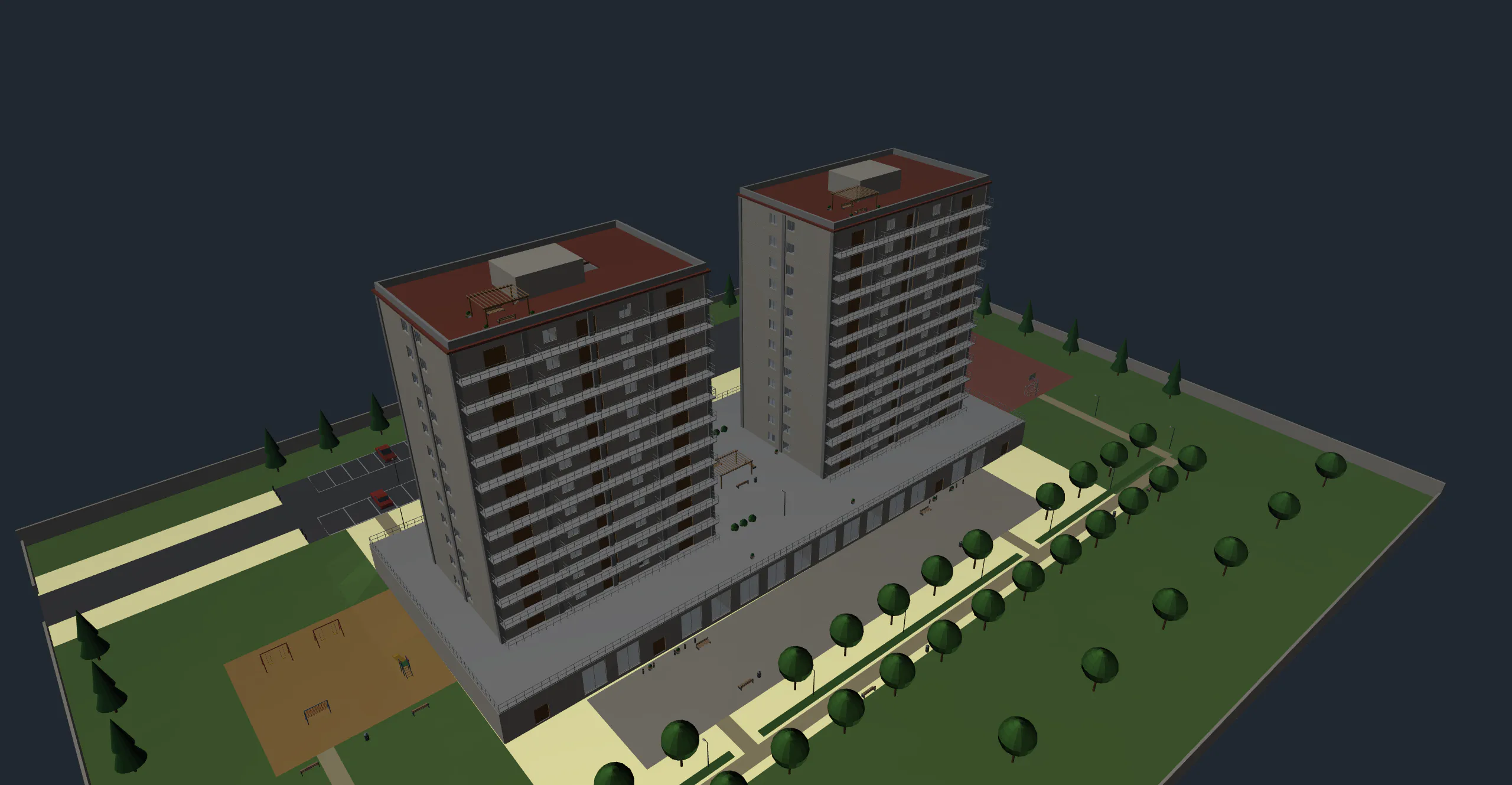
Say it, and it gets drawn.
ATA CAD connects to your own Claude account. You write the request in Turkish and the program runs the commands on your screen.
"Build a three-storey villa on the sloping parcel: the basement opens onto the pool terrace, the ground floor cantilevers to the south on V columns, the upper floor has a gable roof. Add the garage, the entrance court, the pool and the garden paths; furnish the rooms."
- Every action is visible on screen and can be undone in one step.
- You set the approval threshold.
- ATA CAD charges nothing extra for AI; you use your own subscription.
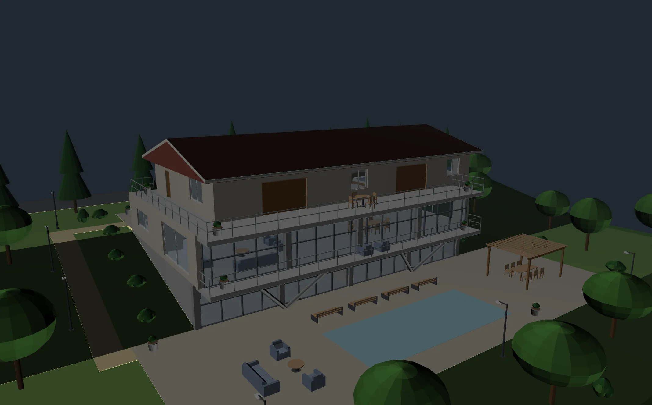
From the program's own screen.
All three videos are edited from real screen recordings.
 8:02
Two towers, from parcel to IFC
Structural frame, services, landscape, compliance check and construction sequence animation.
 6:26
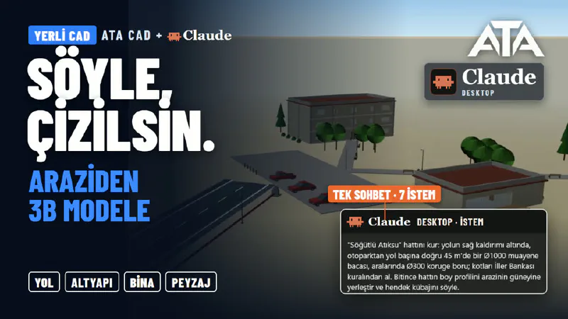
From terrain to 3D model
Terrain, road, waste water line, buildings and landscape in a single chat.
 13:50
Road design: from typical section rules to quantities
Alignment, typical section rules, superelevation, walls, cross-section sheet and quantity take-off.
Your data stays with you.
Every output is in an open format and opens in other programs.
DWG and DXF files are read; DWG is not written. Drawings are delivered as DXF.
| Deliverable | Format |
|---|---|
| Longitudinal profile sheet | DXF |
| Cross-section sheets | DXF |
| Earthwork volume schedule | XLSX · CSV |
| Mass haul diagram | DXF |
| Periodic volumes | XLSX |
| Utility network table | XLSX |
| Trench cross-section · manhole detail | DXF |
| Compliance report | XLSX · PDF · DXF |
| Alignment and surface data | LandXML |
| 3D model | IFC 4.3 · glTF |
Try it on your own project.
- Fill in the form; once your request is approved, the link to the installer arrives in your e-mail.
- Open the program and enter your name and phone number. The 30-day trial starts at that moment.
- Use it on your own project.
The trial is available once per computer. During the trial, DXF, Excel, CSV and LandXML outputs carry a "DEMO" stamp.
- Once your request is approved, download the installer from the link in the e-mail and install it.
- Open the program and enter your name and phone number. The 30-day trial starts at that moment.
- Use it on your own project.